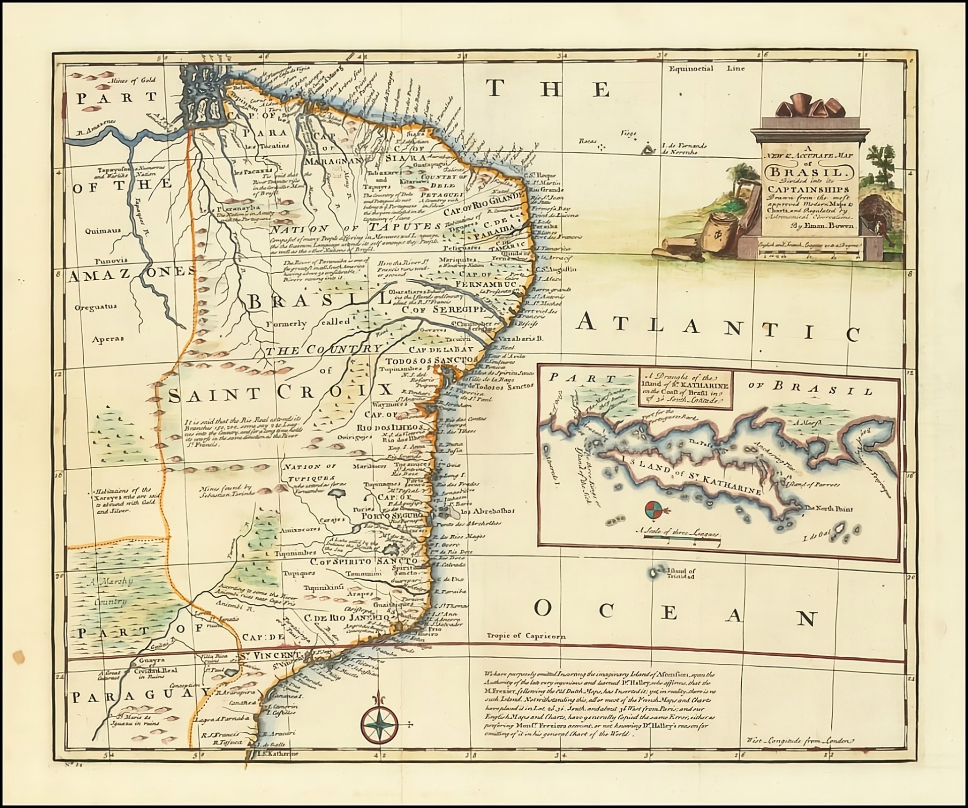
Bowen - A New & Accurate Map of Brasil. Divided into its Captainships Drawn from the most approved Modern Maps & Charts.
Mid-18th-century engraved map of Brazil by Emanuel Bowen, depicting the Portuguese captaincies and major coastal and interior features from the Amazon to the southern provinces. Richly annotated with geographic and exploratory notes, and featuring a decorative cartouche and inset map.
- Date
- 1744
- Origin
- London
- Period
- Colonial Period (1500–1822)
- Materials
- Hand Colored
- Dimensions
- 17 x 14 inches
- Condition
- VG+
Provenance
Ruderman Rare Maps
Historical Context
Bowen's map of Brazil is one of the most interesting English language maps of Brazil from the middle of the 18th Century.
Extending from the Amazon to St. Katherine and centered on the Bahia Todos Santos, it shows Brazil divided into its Portuguese Captaincies.
The map is richly annotated with notes concerning the geography, indigenous peoples and exploration of the region, including a note regarding the omission of the mythical island of Ascension, based upon the work of Sir Edmund Halley.
Includes a decorative cartouche and a large inset of the Island of St. Katherine (Santa Catarina).
Emanuel Bowen (1694?-1767) was a British engraver and print seller. He was most well-known for his atlases and county maps. Although he died in poverty, he was widely acknowledged for his expertise and was appointed as mapmaker to both George II of England and Louis XV of France. His business was carried on by his son, Thomas Bowen. He also trained many apprentices, two of whom became prominent mapmakers, Thomas Kitchin and Thomas Jeffreys.
Why This Item Matters
- Visual Record of Portuguese Captaincies – Captures Brazil's colonial administrative divisions at a decisive moment in the consolidation of Portuguese imperial authority.
- Enlightenment-Era Cartographic Scholarship – Reflects the scientific rigor of the period, including the deliberate rejection of mythical geography (e.g., omission of Ascension per Halley).
- Strategic Atlantic Perspective – Emphasizes Bahia and Santa Catarina, underscoring Brazil's geopolitical and maritime importance in the 18th-century Atlantic world.
- Work of a Royal Cartographer – Produced by Emanuel Bowen, official mapmaker to both George II and Louis XV, linking British and French intellectual recognition to the mapping of Portuguese America.
Cite This Page
"Bowen - A New & Accurate Map of Brasil. Divided into its Captainships Drawn from the most approved Modern Maps & Charts.," Brazilian Heritage Collection, accessed September 19, 2026, https://www.brazilianheritagecollection.com/collection/bowen-map-of-brasil-1744.
Disclaimer: The information presented here represents our best-faith scholarly understanding based on available evidence. The Brazilian Heritage Collection does not offer legal guarantees of authenticity. Serious inquiries regarding provenance documentation are welcome from qualified researchers and institutions.